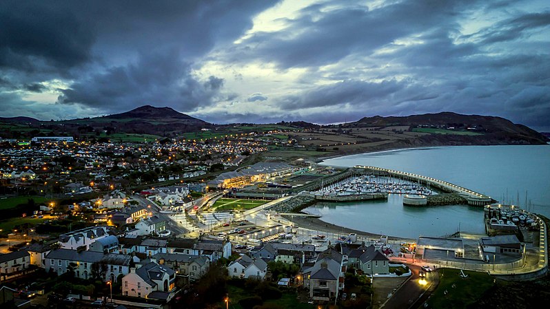

Greystones old harbour had fallen into disrepair since it was originally built in the early 1800s and required a major investment to bring it into the 21st century.
The project involved most aspects of marine civil engineering including dredging, reclamation, beach nourishment, rock armour, concrete armour, marine piling, underwater stone screeding, extensive diving operations, seawalls, coastal revetments, breakwaters and slipways all of which are designed to function at all states of the tide. The breakwaters are designed for a 1 in 2,000 year storm event.
Part of the project contained the remains of an old disused Wicklow County Council landfill. Significant project works included landfill remediation involving the removal of approximately 9,000m³ of existing landfill material and sealing of the landfill cell using a bespoke geo-synthetic lining system and spreading of cell capping material and landscaping and seeding to form part of a public park. Further works included protection works to eliminate future coastal erosion along the boundary of the old dump location.

1710 Map - before any harbour
Arup carried out the design of permeable breakwater roundheads that reduce wave heights at the harbour mouth and the sustainable approach to dealing with rapidly eroding cliffs. These new coastal protection measures retain and protect the existing cliff walk in an area that has suffered the effects of coastal erosion.
Arup adopted the most sensible and cost effective approach of managing the natural retreat of the cliff, rather than trying to stop it. Beach nourishment was adopted in areas where the erosion would have been unsustainable.
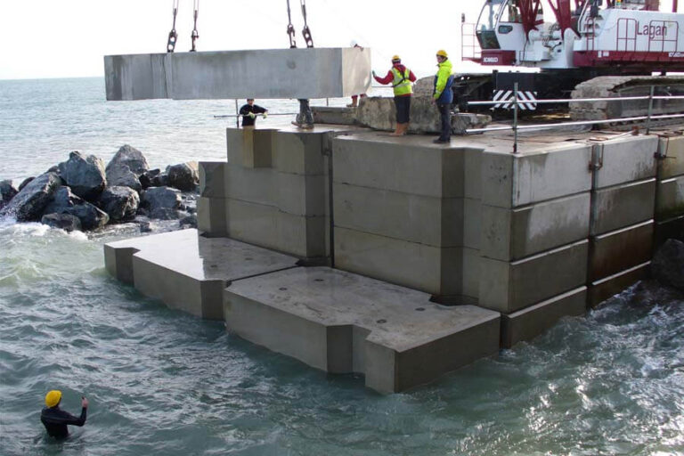
The main structural elements of this complex maritime project are two breakwaters with a total length of 530m. The team decided on a design that would minimise the amount of floating plants and would that way minimise the effect the weather had on the construction programme.
Arup therefore designed the breakwaters to be built using pre-cast concrete blocks. The seaside face of the breakwater is protected by a revetment made up of 3-6tn rock armour and 14tn antifer blocks.
As part of the specialist transportation planning and traffic engineering input, Arup undertook the traffic assessment and developed the construction traffic management plan and programme.
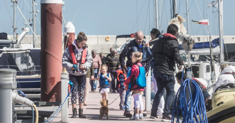

Following a temporary Court Order allowing two fishing vessels (MFV Dignity and MFV Blue Fin) to berth and unload catch and gear from the North Breakwater, we have had a risk assessment carried out, to ensure people using the pier are not exposed to undue risk.
It is clear from this assessment that the North Breakwater at Greystones is not suitable for commercial activities taking place alongside members of the public and therefore, to ensure and manage the safety of the public, the breakwater must be closed during these activities.
In line with the Harbour Bye-laws, the owner of these two fishing vessels are required to provide details of arrival and departure times to the Harbour Master, to allow for the breakwater to be cleared of the public and the gates to the breakwater to be locked. This will allow the gates to be opened once the areas has been cleared and secured.
The health and safety of users of the North Breakwater and the harbour are the primary concern and we trust people will abide by the measure
brought in for their safety.
The public spaces are managed and maintained by Sensori FM and you can contact them via email
The public spaces are managed and maintained by Sensori FM and you can contact them via email
You can contact Greystones Harbour Marina via their website or by calling +353 (1)2873131
Glenveagh Property built the apartments but they are all sold.
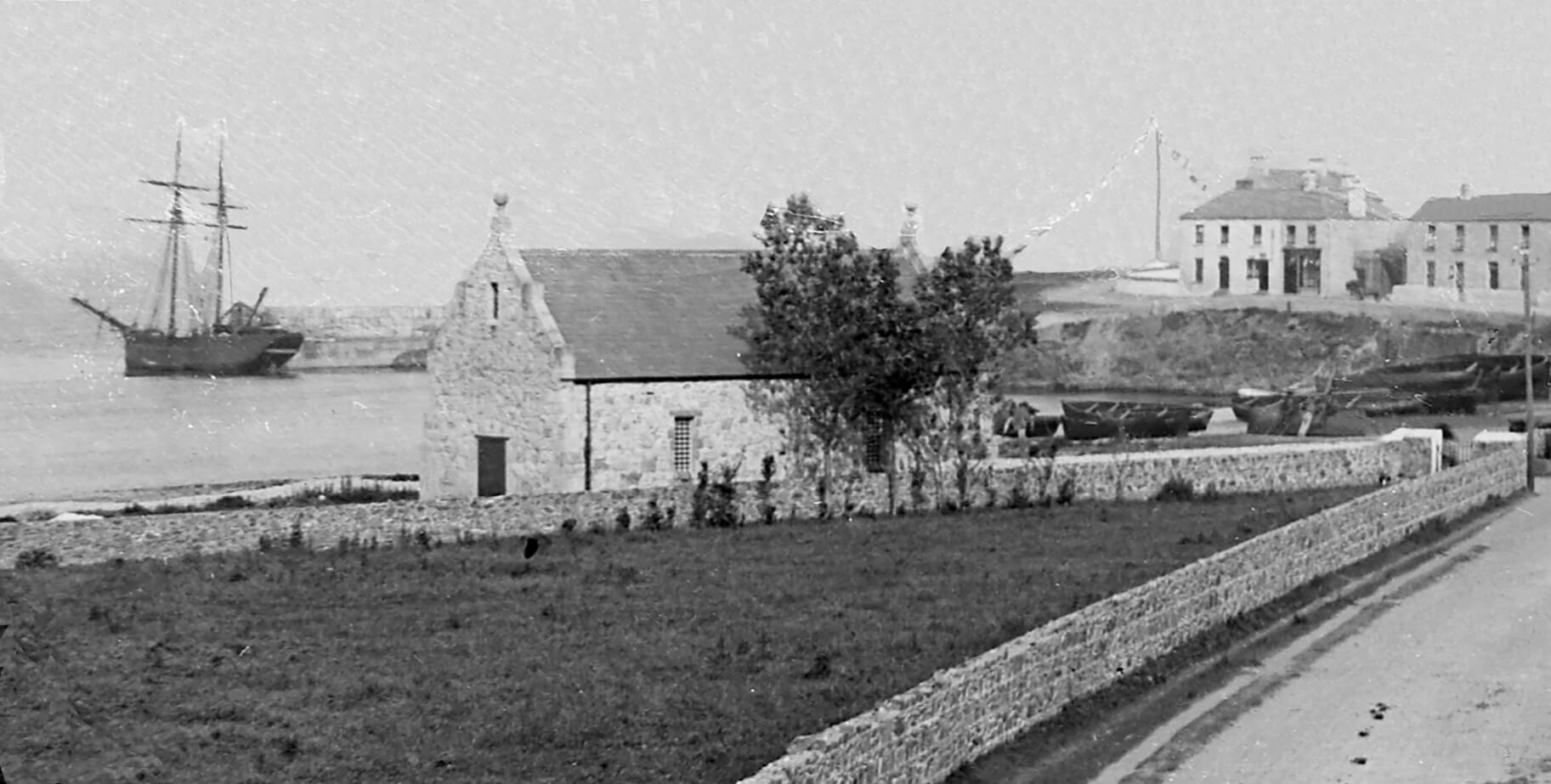
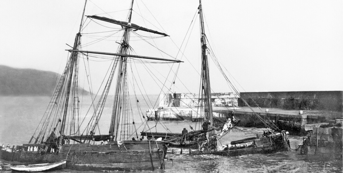
The original harbour dated back to early Victorian times when “grey” rock was quarried out to create a small harbour. The newly formed harbour offered little protection from north / north easterly storms and in the late 1800s a northern breakwater was constructed out from the beach to provide a more protected harbour. The new structure was not a success and as time moved on siltation within the harbour became a further issue. If north easterlies and siltation weren’t bad enough, coastal erosion was also a major issue. Coastal erosion during the 19th century resulted in the realignment of the railway further inland, with the loss of many coastal structures including the sea wall in circa 1929 and Jubilee Castle in circa 1930. Winter storms between 1929 and 1931 devastated the harbour community with the loss of about 15 houses to the sea along Beach Road. Erosion of the sea cliffs along the north beach between Greystones Harbour and Bray Head was estimated at up to between ½ metre and ¾ metre every year – that is 50 to 75 metres of movement inland in just 100 years.
As the condition of the harbour deteriorated and with increasing health and safety concerns together with a reducing public amenity value, something had to be done. In the intervening years a number of proposals were put together by interested parties including in 1996 proposals which included 712 units and a hotel. Plans for the redevelopment of the harbour were given a more formal structure with proposals for a new harbour/marina included in the in the 1999 Local Area Plan for Greystones/Delgany.
The project is a Public Private Partnership (PPP) between Wicklow County Council and Sispar Limited. Wicklow County Council and Sispar Limited entered into a Concession Agreement on the 19th December 2007 relating to the design, construction, operation, maintenance and financing of a marine and landside development for the town of Greystones, incorporating a new harbour, coastal protection works, a yachting marina and a costal public park. The Concession Agreement for the management, maintenance and operation of the development is for a 30 year period commencing in 2016.
The development was approved by An Bord Pleanála in August 2007. Prior to the approval of An Bord Pleanála being sought for the proposed development a Compulsory Purchase Order was made by Wicklow County Council on 21st December 2004. The compulsory purchase order application to An Bord Pleanála was put in abeyance pending receipt of the application for approval for the development.
A formal application for approval under Section 175 of the Planning and Development Act 2000 for a public private partnership project development, at Greystones Harbour and the North Beach Area was made to An Bord Pleanála in December 2005. Following public consultation, oral hearings and the submission of revised plans for a smaller scale development, Wicklow County Council was granted approval by in August 2007.
A public-private partnership (PPP) is an arrangement between a public authority and a private partner designed to deliver a public infrastructure project and service under a long-term contract.
In the context of investing in public infrastructure, Public Private Partnerships (PPPs) are the only off-balance sheet mechanism open to the Government that can comply with EU fiscal rules. This means they provide an option that allows the delivery of additional infrastructure and services than might otherwise be possible. Some of the advantages associated with PPPs are that they allow the public sector to avail of private sector expertise and innovation and that their deployment allows the State to share risk between the public and private sectors.
Wicklow County Council would not have proceeded with the project has it not opted for a PPP as it was not able to finance the project from its own resources and there was no funding available from either the EU or the central exchequer.
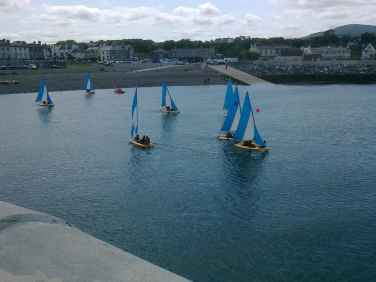
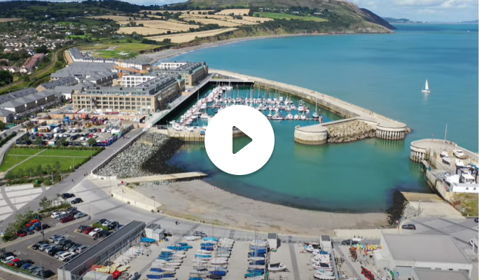
Greystones Harbour has been developed into a modern harbour and marina facility with over €80 million invested into the development of public infrastructure. Central to the development is a new functioning public harbour including state-of-the-art clubhouses accommodating five marine based clubs, significant reclamation and coastal protection works including the development of the north and south breakwaters – over 400 metres, dredging and beach nourishment works and the provision of marine infrastructure including two slipways and storage facilities. The marina, which is the deepest on the east coast of Ireland, has capacity for up to 250 vessels and is considered easy and safe for vessels to navigate. The development includes significant improvements to the public realm including a central plaza known as “Harbour Square”, a boardwalk linking the harbour area to the Bray to Greystones Cliff Walk, a 16 acres public park known as “Darcy’s Field” as well as car parking and electric charging facilities. In addition, the concession agreement provides for a 30-year operation and maintenance contract whereby Sispar Ltd is responsible for maintenance and upkeep of the harbour including routine cleaning and day to day management of the facility.
Sispar Ltd was a joint venture consortium of Park Developments and John Sisk & Son. In 2006, following a public competition, Sispar Ltd was appointed preferred bidder with Arup as design consultants. As a result of the economic crisis and property crash Sisk is sole remaining company in Sispar.
Sisk is an Irish owned family business which has been building some of Ireland’s most recognised landmarks since 1859. It is a major construction and engineering company, the largest in Ireland and with business in the UK and Europe. Sisk is still owned by the family who set it up in Cork over 160 years ago and takes pride in what it builds and the people who work there.
Originally the development was due for completion by December 2013, however, following the economic crisis in 2008 the housing and apartment elements of the development were taken over by Nama. At the time Nama took over all loans over €5 million regardless of whether or not they were performing.
The landside residential element of the project recommenced in 2015 with Sisk and Wicklow County Council securing new backing from an investment fund called Targeted Investment Opportunities. It’s interest in the residential development aspects of the Greystones Harbour Project transferred to Targeted Investment Opportunities plc
The winning bid design rationalised the harbour entrance and the marina shape to optimise cut/fill quantities and separate new buildings from the open sea. The bid design also included environmentally sustainable solutions for retention and protection of the old municipal dump and coastal protection by beach nourishment measures. Retaining the natural sea cliffs by using beach nourishment to manage rates of coastal erosion was more appropriate than building a ‘hard’ and ‘engineered’ revetment solution along the north beach.
Numerical modelling of the coastline and proposed marina and harbour layout was required as part of the preliminary design process. Modelling of coastal erosion was used to predict the beach nourishment required to manage erosion rates within ‘do nothing’ rates. Modelling of wave heights within the harbour and marina was required to demonstrate compliance with the strict limits on marina sea conditions.
The site contained an old municipal ‘dump’ underlying a future public park. Through application of sustainable principles, proper investigation, analysis and risk assessment, both An Bord Pleanála and the Environmental Protection Agency accepted the solution of keeping the material in situ, as it poses no risk to the environment or end users within the overall design. Similar sustainability principles were applied to the coastal protection works. Apart from revetment to protect against erosion of old landfill material, the beach nourishment solution allowed preservation of the natural cliffs, the habitats, environment and safe recreational uses for the entire north beach area.
The key design element was the 400m+ of breakwaters. Many designs were considered, including rockfill embankments, sheet-piled cofferdams and large pre-cast caissons. Given the constraints on space, height, ground conditions and environment, a pre-cast concrete block wall and rockfill revetment ‘hybrid’ structure was chosen. A design was conceived that could for the most part be constructed on ‘dry land’, minimising the use of floating plant and attendant weather dependency risks. The base of the breakwater was designed to be porous, allowing use of the ‘Goda’ design method.
As typical for detailed design of significant maritime structures, scaled physical modelling was conducted by a company called DHI in Copenhagen. Flume testing of the breakwater section to confirm stability, revetment block (antifer) and rock-armour size and overtopping was undertaken. A 3D scaled model of the entire harbour and marina was also constructed and tested for performance under wave conditions ranging from a one-year return event up to the design 100-year return event. Wave heights were thus measured to ensure compliance with design requirements. This modelling yielded design developments in breakwater and revetment design, most notably the need for ‘porous’ roundheads at the harbour entrance to reduce wave reflection impacts
The project area covered approximately 70 acres of which 36 acres were foreshore. Of the 36 acres of foreshore only about 5 acres was reclaimed for development. Approximately 32 acres of land was already in the Council’s ownership with just under 1.9 acres of private land purchased by CPO. Between 4-5 acres of the reclaimed land has been developed for private housing with the balance of approximately 6-7 acres from brownfield site. Of the 70 acres contained in the CPO approximately 12 acres transferred to private ownership which was necessary in order to fund the redevelopment of harbour. The freehold title of all other land is retained by the Wicklow County Council.
Why are fishing boats now moored to the north breakwater?
The design of the harbour does not envisage what is happening with commercial fishing boats mooring up against the north breakwater, as these boats were not operating from Greystones before the construction of the new harbour and marina.
Prior to the Greystones Harbour PPP project, the original moorings for fishermen consisted of “swing moorings” within the old harbour area, which was in a state of disrepair and provided limited shelter. The current harbour and marina were designed in the mid-2000’s, in accordance with Wicklow County Council’s requirements which included the provision of appropriate moorings in the new harbour for the type of vessel operating out of the harbour prior to the redevelopment.
The moorings installed in the outer harbour were designed for the type of fishing vessels which would have featured in the harbour prior to the redevelopment and comprised of linear (fore and aft) moorings located within the outer harbour, away from fixed structures and the harbour beach. This development of the harbour progressed through the planning approval process, including a public oral hearing, local consultation led by Wicklow County Council as the promoter of the project, when all stakeholders had their opportunity to engage. Following planning approval, detailed design and construction took place.
The primary function of the north and south breakwaters is to protect the harbour and coastline from erosion by the sea, acting as a barrier to slow water speed. This is what the breakwaters were designed and built for, following the project brief from Wicklow County Council.
Why have the gates to the north breakwater been locked ?
The gates were installed to curtail access to the north breakwater on occasions where there is an increased risk to public safety.
Unauthorised moorings for a number of fishing boats have been illegally installed on the north breakwater and are being used by a number of fishing boats without any permission or agreement. It was never intended that large commercial fishing boats would moor to the north breakwater and damage has now been done to the structure, the extent of which is being assessed.
These boats have also been restricting access to the safety ladders such that they are inaccessible should a member of the public fall into the water.
Unauthorised access by vehicles to the north breakwater is not permitted for obvious safety reasons and SisPar is managing the risk to members of the public with the use of the gates. However, locks were repeatedly broken and access gained by vehicles parking illegally and unloading boats. These matters have been reported to the Gardai in Greystones.
Why can a deal not be reached to accommodate the fishermen who want to moor their boats in Greystones ?
Extensive discussions took place with those wanting to moor their commercial fishing boats in the new harbour.
The fishermen currently operating without authorization were offered the opportunity to unload their catch from the north breakwater on the basis they would then moor their boats in the marina.
The deal they were offered would also have seen them avail of the fishermen’s huts that were built in the harbour specifically to store fishing gear but they decided not to do this.
Have all options been explored to facilitate the fishermen in the harbour, for example the use of the area beside the public slipways?
Yes, all options have been examined and the engineers who originally designed and helped build the harbour have said there are no other options available to moor boats of this size as it was not designed for them.
These boats were not fishing out of Greystones when the harbour was being designed and therefore it was not designed to accommodate them. These larger vessels have only started to come in to Greystones since the new harbour was built.
There has been an increase in the level of dangerous and anti-social behaviour taking place with people jumping into the water.
An independent review has highlighted these activities as posing serious risk to public health and safety, particularly during summer months when there is increased activity.
In order to deter antisocial behaviour and unauthorised activity we have placed security on the North breakwater.
No vehicles are permitted on the North Breakwater, it is a public amenity area for pedestrian use.